





Alle Auktionen / Bücher, Karten, Handschriften / Germany - County of Erbach: in southern Hesse

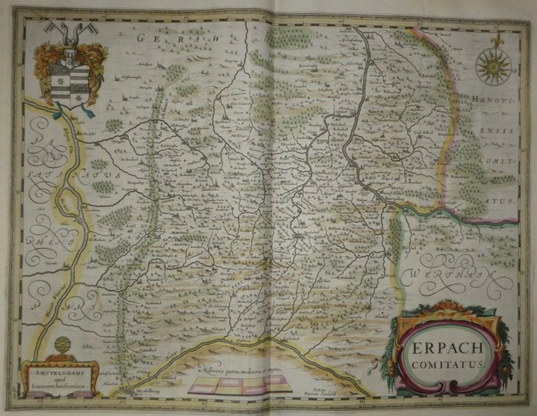
Old copper-engraved map of the county of Erbach (Odenwald, Germany) hand-enhanced, by Johannes Janssonius, etched by Petrus Kaerius, and published in 1633 in the Mercator-Hondius atlas. In it the county of Erbach is framed by three rivers: the Rhine to the west, the Main to the north and east, and the Neckar to the south. The title cartouche, at the bottom right, is adorned with a mascaron and garlands of fruit. At the upper left lie large armorials with stars and fasces, topped by a helm with mantling and a crest with horns. The publisher’s address occupies a second cartouche crowned with an armillary sphere, at the bottom left. A wind rose with a fleur-de-lis and a scale ("Milliaria parva, mediocria et magna") complete the décor. The relief is depicted by small hills, forests by groups of trees, and towns by vignette views. The Bergstrasse ("Berchstraet") is drawn as a tree-lined avenue from Darmstadt to Heidelberg. Neighbouring territories are named in large, calligraphic letters: Palatinate on the Rhine, Geraw, the county of Hanau and Wertheim. Among the localities: Erpach, Michelstadt, Heydelberg, Wormbs, Darmstat, Aschaffenburg, Miltenberg, Amorbach, Eberbach, Hirschorn. French text on the verso (pp. 449 and 452), with banner, initial capital, and drop-cap carved in wood. Signature of the engraver "Petrus Kærius Cælavit" at the bottom of the map. - Dimensions: on sheet: 56 x 47.5 cm; on plate (map): 46.9 x 35.3 cm - Condition: Very beautiful overall state for a map of this period. Presence of a few brown damp-stain traces in the upper margin and minor marks. See photos for more details. Atlas Mercator-Hondius - The atlas called "Mercator-Hondius" reprises the work of Gerardus Mercator, whose copper plates were purchased by Jodocus Hondius in 1604. This French edition of 1633 is signed by his son Henricus Hondius and his son-in-law Joannes Janssonius, who added new maps to it. Johannes Janssonius – Johannes Janssonius (Jan Jansson), born in Arnhem in 1588 and died in Amsterdam in 1664, was a Dutch publisher and cartographer. Son of a bookseller-publisher, he married in 1612 the daughter of the cartographer Jodocus Hondius and settled in Amsterdam. Associated with his brother-in-law Henricus Hondius, he continued and expanded the Mercator-Hondius atlas from the 1630s, which he later developed under the title Atlas Novus. This map was engraved by Pieter van den Keere (Petrus Kaerius, 1571 - c. 1646), the Flemish engraver active in Amsterdam and brother-in-law of Jodocus Hondius.
Schätzpreis:€150
Zur AuktionAlle Objekte ansehen vonCatawikioderBücher, Karten, Handschriften
Schätzpreis:
€150
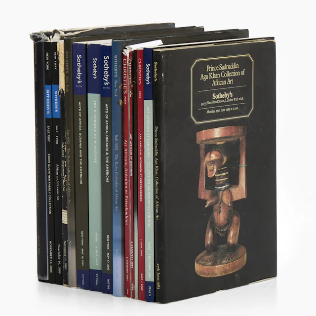
AUKTIONSKATALOGER, 15 st mellan 1983-2009, Sotheby's - Chtisties.
10/23/2026
€49.52
Schätzw.: €89.94
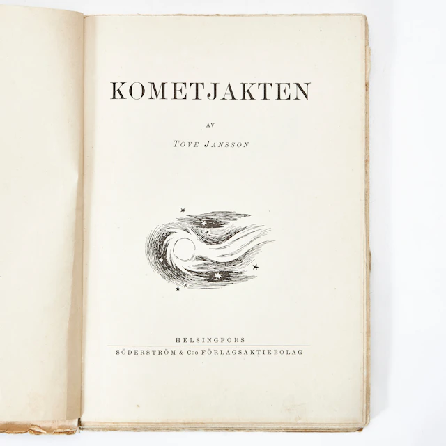
KOMETJAKTEN AV TOVE JANSSON, första upplagan, Helsingfors 1946.
10/23/2026
€107.85
Schätzw.: €179.89
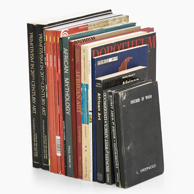
BÖCKER, TIDSKRIFTER, diverse om primitivism och afrikansk konst, bl.a. Tribal.
10/23/2026
€49.43
Schätzw.: €89.94




Bringen Sie Ihre Auktion zu Sammlern weltweit!
Jetzt eintragen lassenMit der Anmeldung stimmen Sie der Datenschutzrichtlinie zu. Jederzeit abmelden.
Barnebys HQ
Brahegatan 10
BOX 5038
114 37 Stockholm
